
Thank you for supporting this site ❤️
Make a donation
Make a donation
Gear up for your next adventure:
As an Amazon Associate, this site earns from qualifying purchases at no extra cost to you.
Mamba topographic map
Click on the map to display elevation.
Thank you for supporting this site ❤️
Make a donation
Make a donation
Gear up for your next adventure:
As an Amazon Associate, this site earns from qualifying purchases at no extra cost to you.
About this map
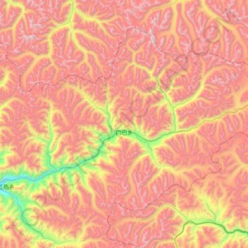
Name: Mamba topographic map, elevation, terrain.
Location: Mamba, Maizhokunggar County, Lhasa, Tibet, China (29.91745 92.02756 30.31851 92.62453)
Average elevation: 5,037 m
Minimum elevation: 3,912 m
Maximum elevation: 5,937 m
Thank you for supporting this site ❤️
Make a donation
Make a donation
Gear up for your next adventure:
As an Amazon Associate, this site earns from qualifying purchases at no extra cost to you.