
Thank you for supporting this site ❤️
Make a donation
Make a donation
Gear up for your next adventure:
As an Amazon Associate, this site earns from qualifying purchases at no extra cost to you.
Chancamayo topographic map
Click on the map to display elevation.
Thank you for supporting this site ❤️
Make a donation
Make a donation
Gear up for your next adventure:
As an Amazon Associate, this site earns from qualifying purchases at no extra cost to you.
About this map
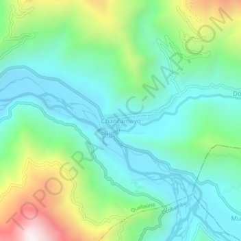
Name: Chancamayo topographic map, elevation, terrain.
Location: Chancamayo, Quelloúno, La Convención, Cusco, Perú (-12.64706 -72.40216 -12.60706 -72.36216)
Average elevation: 1,158 m
Minimum elevation: 876 m
Maximum elevation: 1,884 m
Thank you for supporting this site ❤️
Make a donation
Make a donation
Gear up for your next adventure:
As an Amazon Associate, this site earns from qualifying purchases at no extra cost to you.