
Thank you for supporting this site ❤️
Make a donation
Make a donation
Gear up for your next adventure:
As an Amazon Associate, this site earns from qualifying purchases at no extra cost to you.
Beerst topographic map
Click on the map to display elevation.
Thank you for supporting this site ❤️
Make a donation
Make a donation
Gear up for your next adventure:
As an Amazon Associate, this site earns from qualifying purchases at no extra cost to you.
About this map
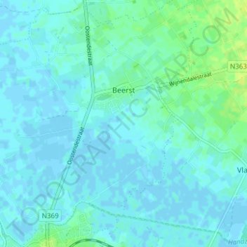
Name: Beerst topographic map, elevation, terrain.
Location: Beerst, Diksmuide, West Flanders, Flanders, 8600, Belgium (51.03418 2.84395 51.07308 2.90308)
Average elevation: 3 m
Minimum elevation: -3 m
Maximum elevation: 14 m
Thank you for supporting this site ❤️
Make a donation
Make a donation
Gear up for your next adventure:
As an Amazon Associate, this site earns from qualifying purchases at no extra cost to you.