Geolocate

Deltebre topographic map

Click on the map to display elevation.

About this map

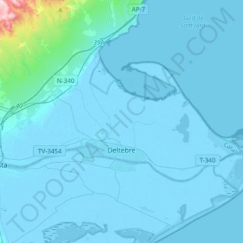
Name: Deltebre topographic map, elevation, terrain.

Location: Deltebre, Baix Ebre, Tarragona, Catalonia, 43580, Spain (40.69435 0.59986 40.79393 0.86702)

Average elevation: 21 m

Minimum elevation: -7 m

Maximum elevation: 502 m

Other topographic maps

Click on a map to view its topography, its elevation and its terrain.

Salt de la Caramella

Spain > Catalonia > Baix Ebre > Roquetes

Average elevation: 642 m

Boca de Foix

Spain > Catalonia > Baix Ebre > Tivenys

Average elevation: 379 m

Gear up for your next adventure:

🥾Mountain Trail Shoes - High-traction shoes for mountain trails
🚑Survival Whistle - Signal for help across long distances in mountains
🥾Waterproof Hiking Boots - Boots keeping your feet dry in wet conditions
🧴First Aid Kit - Essential first aid supplies for outdoor emergencies
🛁Quick-Dry Microfiber Towel - Space-saving towel that dries rapidly on the move

As an Amazon Associate, this site earns from qualifying purchases at no extra cost to you.