Geolocate
👉 Easily get elevation data in JSON, GeoTIFF and KML formats using Elevation API
Thank you for supporting this site ❤️
Make a donation

Virginia topographic map

Click on the map to display elevation.

About this map

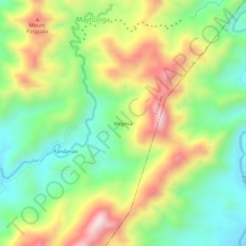
Name: Virginia topographic map, elevation, terrain.

Location: Virginia, Laua-an, Antique, Western Visayas, Philippines (11.11577 122.11035 11.15577 122.15035)

Average elevation: 335 m

Minimum elevation: 101 m

Maximum elevation: 673 m

Gear up for your next adventure:

🎒Hiking Daypack - Lightweight and durable backpacks for day trips and excursions
🔦LED Headlamp - Hands-free lighting for early morning starts or late finishes
🧰Survival Kit - Essential gear for emergencies in the wilderness
🦶Hiking Shoe Insoles - Added support for high arches and long days on feet
❄️Traction Ice Cleats - Slip-on spikes for icy trails and winter hiking

As an Amazon Associate, this site earns from qualifying purchases at no extra cost to you.