
North Haven Island topographic map
Interactive map
Click on the map to display elevation.
About this map
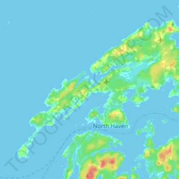
Name: North Haven Island topographic map, elevation, terrain.
Average elevation: 6 m
Minimum elevation: -1 m
Maximum elevation: 59 m
Other topographic maps
Click on a map to view its topography, its elevation and its terrain.
Penobscot Bay
United States > Maine > Knox County > North Haven
Penobscot Bay, North Haven, Knox County, Maine, United States
Average elevation: 0 m