
Daugavpils topographic map
Interactive map
Click on the map to display elevation.
About this map
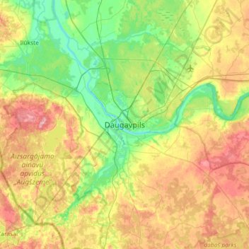
Name: Daugavpils topographic map, elevation, terrain.
Location: Daugavpils, Latgale, Latvia (55.71123 26.35593 56.03123 26.67593)
Average elevation: 131 m
Minimum elevation: 80 m
Maximum elevation: 216 m
Other topographic maps
Click on a map to view its topography, its elevation and its terrain.
Černostes ezers
Latvia > Latgale > Rēzeknes novads > Černoste
Černostes ezers, Černoste, Rēzeknes novads, Latgale, Latvia
Average elevation: 165 m