
Sakaka topographic map
Interactive map
Click on the map to display elevation.
About this map
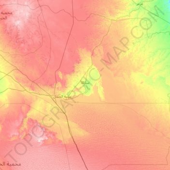
Name: Sakaka topographic map, elevation, terrain.
Location: Sakaka, Provinz al-Dschauf, Saudi-Arabien (28.91363 39.48188 30.96334 41.99684)
Average elevation: 727 m
Minimum elevation: 459 m
Maximum elevation: 1,062 m
Other topographic maps
Click on a map to view its topography, its elevation and its terrain.
Tubarjal
Saudi-Arabien > Provinz al-Dschauf
Tubarjal, Provinz al-Dschauf, Saudi-Arabien
Average elevation: 738 m
مطار جرية الجنوب غربي
Saudi-Arabien > Provinz al-Dschauf > Al-Qurayyat
مطار جرية الجنوب غربي, Al-Qurayyat, Provinz al-Dschauf, Saudi-Arabien
Average elevation: 571 m