Geolocate

Otago topographic map

Click on the map to display elevation.

About this map

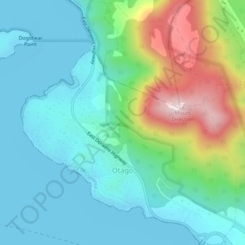
Name: Otago topographic map, elevation, terrain.

Location: Otago, Hobart, City of Clarence, Tasmania, 7017, Australia (-42.81456 147.28107 -42.78502 147.31668)

Average elevation: 110 m

Minimum elevation: -2 m

Maximum elevation: 434 m

Other topographic maps

Click on a map to view its topography, its elevation and its terrain.

Snug Falls

Australia > Tasmania > Hobart > Snug

Average elevation: 336 m

Knocklofty

Australia > Tasmania > Hobart

Average elevation: 185 m

Mount Direction

Australia > Tasmania > Hobart

Average elevation: 166 m

Glebe Hill

Australia > Tasmania > Hobart

Average elevation: 66 m

Selfs Point

Australia > Tasmania > Hobart

Average elevation: 17 m

Waterworks Reserve

Australia > Tasmania > Hobart

Average elevation: 240 m

James Austin Park

Australia > Tasmania > Hobart

Average elevation: 25 m

Perrins Ridge

Australia > Tasmania > Hobart

Average elevation: 467 m

Cartwright Point

Australia > Tasmania > Hobart

Average elevation: 59 m

Tolosa Park

Australia > Tasmania > Hobart

Average elevation: 182 m

Glenrose Park

Australia > Tasmania > Hobart

Average elevation: 181 m

Gear up for your next adventure:

🚲MTB Frame Bag - Carry tools and maps directly on your bicycle frame
🥾All-Terrain Hiking Boots - Versatile boots for varied hiking conditions
🕶️Polarized Sunglasses - Reduces glare from snow and water at high elevations
🥾Waterproof Hiking Boots - Essential footwear for rugged terrain and wet Canadian trails
🔥Emergency Fire Starter - Reliable ignition source for all weather conditions

As an Amazon Associate, this site earns from qualifying purchases at no extra cost to you.