
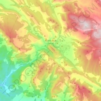
Alcalá de la Selva topographic map
Interactive map
Click on the map to display elevation.
About this map
Name: Alcalá de la Selva topographic map, elevation, terrain.
Location: Alcalá de la Selva, Gúdar-Javalambre, Teruel, Aragón, España (40.30827 -0.79120 40.41489 -0.63419)
Average elevation: 1,524 m
Minimum elevation: 1,097 m
Maximum elevation: 2,017 m