Geolocate

Paulenca topographic map

Click on the map to display elevation.

About this map

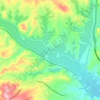
Name: Paulenca topographic map, elevation, terrain.

Location: Paulenca, Gádor, Almería, Andalucía, 04560, España (36.93677 -2.50811 36.97677 -2.46811)

Average elevation: 195 m

Minimum elevation: 122 m

Maximum elevation: 321 m

Gear up for your next adventure:

🧥Waterproof Hiking Jacket - Protect yourself from rain and wind while hiking
🔦LED Headtorch - Bright and durable light for night activities
🥾Trail Hiking Socks - Comfortable socks to prevent blisters and fatigue
🥾Mountain Hiking Boots - High-traction boots for rocky terrain
🕯️Camping Lantern - Illuminates your entire campsite with high-efficiency LEDs

As an Amazon Associate, this site earns from qualifying purchases at no extra cost to you.