Geolocate

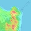
Lagoa Salgada topographic map

Click on the map to display elevation.

About this map

Name: Lagoa Salgada topographic map, elevation, terrain.

Location: Lagoa Salgada, Rio Grande do Norte, Northeast Region, Brazil (-6.20193 -35.55052 -6.09059 -35.44363)

Average elevation: 94 m

Minimum elevation: 42 m

Maximum elevation: 123 m

Other topographic maps

Click on a map to view its topography, its elevation and its terrain.
Natal

Brazil > Rio Grande do Norte > Natal

Average elevation: 21 m

Morro do Careca

Brazil > Rio Grande do Norte > Natal

Average elevation: 25 m

Gear up for your next adventure:

🧢Sun Hat - Wide-brim hat for sun protection
🧤Thermal Hiking Gloves - Grip-enhanced gloves for cold-weather altitude trekking
🥾Hiking Shoes - Durable and comfortable shoes for trail hiking
🦌Outdoor Trail Camera - Monitor wildlife activity near your favorite spots
🪑Insulated Seat Pad - Protect your seat from cold rocks and wet logs

As an Amazon Associate, this site earns from qualifying purchases at no extra cost to you.