Geolocate

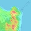
Lagoa Salgada topographic map

Click on the map to display elevation.

About this map

Name: Lagoa Salgada topographic map, elevation, terrain.

Location: Lagoa Salgada, Rio Grande do Norte, Northeast Region, Brazil (-6.20193 -35.55052 -6.09059 -35.44363)

Average elevation: 94 m

Minimum elevation: 42 m

Maximum elevation: 123 m

Other topographic maps

Click on a map to view its topography, its elevation and its terrain.
Natal

Brazil > Rio Grande do Norte > Natal

Average elevation: 21 m

Morro do Careca

Brazil > Rio Grande do Norte > Natal

Average elevation: 25 m

Gear up for your next adventure:

🧭GPS Handheld Device - Reliable GPS navigation for outdoor adventures
🔥Emergency Fire Starter - Reliable ignition source for all weather conditions
🎒Backpack Rain Cover - External shield to keep your entire pack dry
👟Leg Gaiters - Keep debris, mud, and snow out of your boots
🔦LED Headlamp - Hands-free lighting for early morning starts or late finishes

As an Amazon Associate, this site earns from qualifying purchases at no extra cost to you.