Geolocate

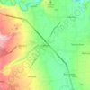
Calinan District topographic map

Click on the map to display elevation.

About this map

Name: Calinan District topographic map, elevation, terrain.

Location: Calinan District, Davao City, Davao Region, 8018, Philippines (7.03652 125.28826 7.33110 125.53069)

Average elevation: 239 m

Minimum elevation: 0 m

Maximum elevation: 1,814 m

Other topographic maps

Click on a map to view its topography, its elevation and its terrain.
Calinan

Philippines > Davao City

Average elevation: 238 m

Gear up for your next adventure:

🥾All-Terrain Hiking Boots - Versatile boots for varied hiking conditions
🥾Approach Boots - Comfortable boots for hiking and climbing approaches
🥾Waterproof Hiking Boots - Boots keeping your feet dry in wet conditions
🥤Collapsible Travel Cup - Saves space and weight in your mess kit
🥾Approach Shoes - Shoes designed for climbing approaches and rugged trails

As an Amazon Associate, this site earns from qualifying purchases at no extra cost to you.