Geolocate

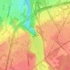
Charny topographic map

Click on the map to display elevation.

About this map

Name: Charny topographic map, elevation, terrain.

Location: Charny, Les Chutes-de-la-Chaudière-Est, Lévis, Chaudière-Appalaches, Québec, Canada (46.69395 -71.28600 46.72949 -71.23136)

Average elevation: 63 m

Minimum elevation: 7 m

Maximum elevation: 107 m

Other topographic maps

Click on a map to view its topography, its elevation and its terrain.

Fleuve Saint-Laurent

Canada > Québec > Lévis

Average elevation: 137 m

Chutes de la Chaudière

Canada > Québec > Lévis

Average elevation: 57 m

Parc du Rapide

Canada > Québec > Lévis

Average elevation: 52 m

Parc de la Vanoise

Canada > Québec > Lévis

Average elevation: 42 m

Parc de la Vanoise

Canada > Québec > Lévis

Average elevation: 42 m

Gear up for your next adventure:

🛰️Satellite Messenger - Emergency communication for areas with no cell service
🥾Hiking Shorts - Breathable shorts suitable for summer hikes
🦯Trekking Poles - Reduced impact on joints for steep topographic climbs
🔦LED Headlamp - Hands-free lighting for early morning starts or late finishes
🥽Outdoor Goggles - Protective eyewear for outdoor activities

As an Amazon Associate, this site earns from qualifying purchases at no extra cost to you.