
Make a donation
Gear up for your next adventure:
As an Amazon Associate, this site earns from qualifying purchases at no extra cost to you.
Oden Bay topographic map
Click on the map to display elevation.
Make a donation
Gear up for your next adventure:
As an Amazon Associate, this site earns from qualifying purchases at no extra cost to you.
About this map
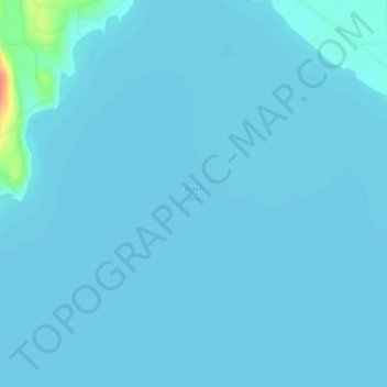
Name: Oden Bay topographic map, elevation, terrain.
Location: Oden Bay, Bonner County, Idaho, United States (48.29877 -116.45274 48.29887 -116.45264)
Average elevation: 626 m
Minimum elevation: 624 m
Maximum elevation: 680 m
Make a donation
Gear up for your next adventure:
As an Amazon Associate, this site earns from qualifying purchases at no extra cost to you.
Other topographic maps
Click on a map to view its topography, its elevation and its terrain.
Oldtown
United States > Idaho > Bonner County
Oldtown is located at 48°11′8″N 117°1′49″W / 48.18556°N 117.03028°W / 48.18556; -117.03028 (48.185623, -117.030158), at an elevation of 2,134 feet (650 meters).
Average elevation: 682 m
Make a donation
Gear up for your next adventure:
As an Amazon Associate, this site earns from qualifying purchases at no extra cost to you.
Clark Fork
United States > Idaho > Bonner County
Clark Fork is located at 48°8′50″N 116°10′42″W / 48.14722°N 116.17833°W / 48.14722; -116.17833 (48.147180, -116.178270), at an elevation of 2,090 feet (637 m) above sea level. The town is situated on the Clark Fork River, on the eastern shores of Lake Pend Oreille. in the northern…
Average elevation: 681 m