
Upper Niumi topographic map
Interactive map
Click on the map to display elevation.
About this map
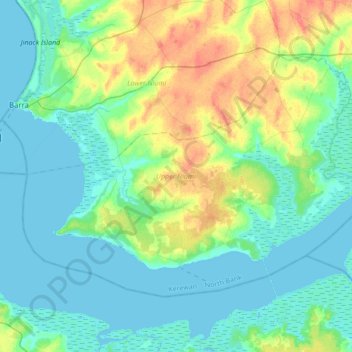
Name: Upper Niumi topographic map, elevation, terrain.
Location: Upper Niumi, Kerewan, North Bank Division, The Gambia (13.30321 -16.53983 13.53213 -16.19606)
Average elevation: 12 m
Minimum elevation: -2 m
Maximum elevation: 48 m
Other topographic maps
Click on a map to view its topography, its elevation and its terrain.
Albreda
The Gambia > North Bank Division > Upper Niumi
Albreda, Upper Niumi, Kerewan, North Bank Division, The Gambia
Average elevation: 8 m
Kunta Kinteh Island
The Gambia > North Bank Division > Upper Niumi
Kunta Kinteh Island, Upper Niumi, Kerewan, North Bank Division, The Gambia
Average elevation: -1 m
Kerewan
The Gambia > North Bank Division
Kerewan, North Bank Division, The Gambia
Average elevation: 18 m