
Thank you for supporting this site ❤️
Make a donation
Make a donation
Gear up for your next adventure:
As an Amazon Associate, this site earns from qualifying purchases at no extra cost to you.
Purhuay topographic map
Click on the map to display elevation.
Thank you for supporting this site ❤️
Make a donation
Make a donation
Gear up for your next adventure:
As an Amazon Associate, this site earns from qualifying purchases at no extra cost to you.
About this map
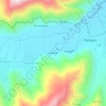
Name: Purhuay topographic map, elevation, terrain.
Location: Purhuay, Ahuaycha, Tayacaja, Huancavelica, 09000, Perú (-12.42364 -74.90288 -12.38364 -74.86288)
Average elevation: 3,423 m
Minimum elevation: 3,228 m
Maximum elevation: 3,927 m
Thank you for supporting this site ❤️
Make a donation
Make a donation
Gear up for your next adventure:
As an Amazon Associate, this site earns from qualifying purchases at no extra cost to you.