
Thank you for supporting this site ❤️
Make a donation
Make a donation
Gear up for your next adventure:
As an Amazon Associate, this site earns from qualifying purchases at no extra cost to you.
Mabera topographic map
Click on the map to display elevation.
Thank you for supporting this site ❤️
Make a donation
Make a donation
Gear up for your next adventure:
As an Amazon Associate, this site earns from qualifying purchases at no extra cost to you.
About this map
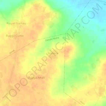
Name: Mabera topographic map, elevation, terrain.
Location: Mabera, Dandin Mahe, Shagari, Sokoto State, Nigeria (12.73115 5.11596 12.77115 5.15596)
Average elevation: 292 m
Minimum elevation: 269 m
Maximum elevation: 304 m
Thank you for supporting this site ❤️
Make a donation
Make a donation
Gear up for your next adventure:
As an Amazon Associate, this site earns from qualifying purchases at no extra cost to you.