
Arandas topographic map
Interactive map
Click on the map to display elevation.
About this map
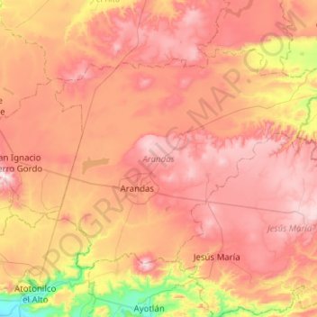
Name: Arandas topographic map, elevation, terrain.
Location: Arandas, Jalisco, México (20.58758 -102.55011 20.91108 -102.05151)
Average elevation: 2,031 m
Minimum elevation: 1,561 m
Maximum elevation: 2,400 m