
Thank you for supporting this site ❤️
Make a donation
Make a donation
Gear up for your next adventure:
As an Amazon Associate, this site earns from qualifying purchases at no extra cost to you.
Maukendorf topographic map
Click on the map to display elevation.
Thank you for supporting this site ❤️
Make a donation
Make a donation
Gear up for your next adventure:
As an Amazon Associate, this site earns from qualifying purchases at no extra cost to you.
About this map
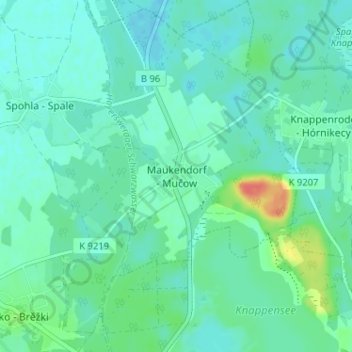
Name: Maukendorf topographic map, elevation, terrain.
Location: Maukendorf, Wittichenau, Bautzen, Sachsen, 02997, Deutschland (51.37703 14.27505 51.41703 14.31505)
Average elevation: 126 m
Minimum elevation: 116 m
Maximum elevation: 160 m
Thank you for supporting this site ❤️
Make a donation
Make a donation
Gear up for your next adventure:
As an Amazon Associate, this site earns from qualifying purchases at no extra cost to you.
Other topographic maps
Click on a map to view its topography, its elevation and its terrain.