
Thank you for supporting this site ❤️
Make a donation
Make a donation
Gear up for your next adventure:
As an Amazon Associate, this site earns from qualifying purchases at no extra cost to you.
Kadehalli topographic map
Click on the map to display elevation.
Thank you for supporting this site ❤️
Make a donation
Make a donation
Gear up for your next adventure:
As an Amazon Associate, this site earns from qualifying purchases at no extra cost to you.
About this map
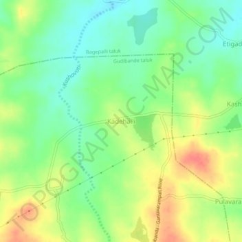
Name: Kadehalli topographic map, elevation, terrain.
Location: Kadehalli, Gudibande taluk, Chikkaballapura, Karnataka, India (13.74488 77.72857 13.78488 77.76857)
Average elevation: 741 m
Minimum elevation: 717 m
Maximum elevation: 771 m
Thank you for supporting this site ❤️
Make a donation
Make a donation
Gear up for your next adventure:
As an Amazon Associate, this site earns from qualifying purchases at no extra cost to you.