
Make a donation
Gear up for your next adventure:
As an Amazon Associate, this site earns from qualifying purchases at no extra cost to you.
Aztec topographic map
Click on the map to display elevation.
Make a donation
Gear up for your next adventure:
As an Amazon Associate, this site earns from qualifying purchases at no extra cost to you.
Aztec
Yet another area managed by the BLM, this area was formed about the same time as the Bisti and Ah-Shi-Sle-Pah. This region offers a uniquely different scale of landscape. Hoodoo in this region are massive and the terrain much greater in elevation differences, thereby exposing a greater geological time frame than the Bisti or Ah-Shi-Sle-Pah. This region is a bit more accessible due to oil field roads traversing the region. However, extreme caution is required when driving on as these roads as they are impassible when wet.
Make a donation
Gear up for your next adventure:
As an Amazon Associate, this site earns from qualifying purchases at no extra cost to you.
About this map
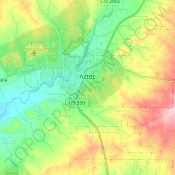
Name: Aztec topographic map, elevation, terrain.
Location: Aztec, San Juan County, New Mexico, United States (36.77639 -108.03648 36.85535 -107.91504)
Average elevation: 1,776 m
Minimum elevation: 1,682 m
Maximum elevation: 1,934 m
Make a donation
Gear up for your next adventure:
As an Amazon Associate, this site earns from qualifying purchases at no extra cost to you.