Geolocate

Manchuria topographic map

Click on the map to display elevation.

About this map

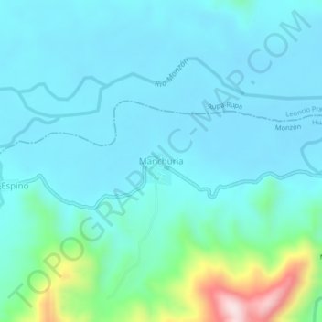
Name: Manchuria topographic map, elevation, terrain.

Location: Manchuria, Monzón, Province of Huamalíes, Huánuco, Peru (-9.22799 -76.18515 -9.18799 -76.14515)

Average elevation: 769 m

Minimum elevation: 697 m

Maximum elevation: 1,160 m

Gear up for your next adventure:

🥫Freeze-Dried Meals - Lightweight, high-calorie nutrition for multi-day treks
🧳Compression Sacks - Maximize space in your backpack by shrinking gear
🧴Outdoor Sunscreen - High SPF protection for high-altitude UV exposure
🧴First Aid Kit - Essential first aid supplies for outdoor emergencies
🧥Softshell Jacket - Windproof and breathable jacket for hiking

As an Amazon Associate, this site earns from qualifying purchases at no extra cost to you.