Geolocate

Atotonilquillo topographic map

Click on the map to display elevation.

About this map

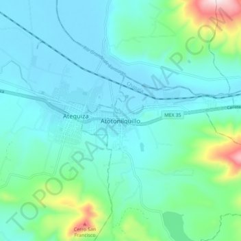
Name: Atotonilquillo topographic map, elevation, terrain.

Location: Atotonilquillo, Chapala, Jalisco, 45930, Mexico (20.35153 -103.16271 20.43153 -103.08271)

Average elevation: 1,622 m

Minimum elevation: 1,511 m

Maximum elevation: 2,149 m

Gear up for your next adventure:

💧Filtered Water Bottle - Safe drinking water on the go
🥾Approach Shoes - Shoes designed for climbing approaches and rugged trails
🩹Compact First Aid Kit - Pre-packed essentials for common trail injuries
🧦Thermal Socks - Warm socks for winter hiking or camping
🧢Outdoor Cap - Protective cap for sun and rain during hikes

As an Amazon Associate, this site earns from qualifying purchases at no extra cost to you.