Geolocate

Pfarrkirchen topographic map

Click on the map to display elevation.

About this map

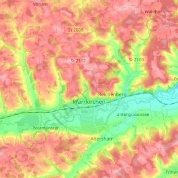
Name: Pfarrkirchen topographic map, elevation, terrain.

Location: Pfarrkirchen, Landkreis Rottal-Inn, Bavaria, 84347, Germany (48.39223 12.89848 48.48486 13.01114)

Average elevation: 429 m

Minimum elevation: 356 m

Maximum elevation: 483 m

Other topographic maps

Click on a map to view its topography, its elevation and its terrain.

Simbach

Germany > Bavaria > Landkreis Rottal-Inn > Simbach > Burgholz > Ewigkeit

Average elevation: 390 m

Gear up for your next adventure:

🧰Multitool Knife - Compact and versatile tool for outdoor use
🥾Trail Running Boots - Durable shoes designed for trail running
👟Trail Running Shoes - Agile footwear for fast-paced topographic exploration
🔋Lithium AA Batteries - Long-lasting power that performs in extreme cold
🕶️Polarized Sunglasses - Reduces glare from snow and water at high elevations

As an Amazon Associate, this site earns from qualifying purchases at no extra cost to you.