
Thank you for supporting this site ❤️
Make a donation
Make a donation
Gear up for your next adventure:
As an Amazon Associate, this site earns from qualifying purchases at no extra cost to you.
Nabutswi topographic map
Click on the map to display elevation.
Thank you for supporting this site ❤️
Make a donation
Make a donation
Gear up for your next adventure:
As an Amazon Associate, this site earns from qualifying purchases at no extra cost to you.
About this map
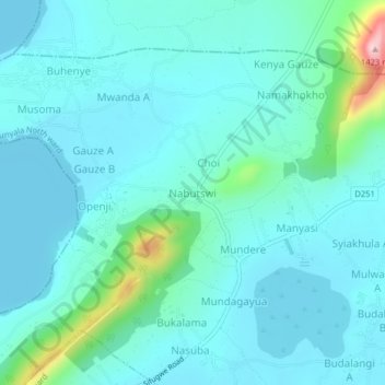
Name: Nabutswi topographic map, elevation, terrain.
Location: Nabutswi, Bunyala North ward, Bunyala, Busia County, Kenya (0.12840 33.98969 0.16840 34.02969)
Average elevation: 1,174 m
Minimum elevation: 1,131 m
Maximum elevation: 1,426 m
Thank you for supporting this site ❤️
Make a donation
Make a donation
Gear up for your next adventure:
As an Amazon Associate, this site earns from qualifying purchases at no extra cost to you.