
Thank you for supporting this site ❤️
Make a donation
Make a donation
Gear up for your next adventure:
As an Amazon Associate, this site earns from qualifying purchases at no extra cost to you.
Scerizza topographic map
Click on the map to display elevation.
Thank you for supporting this site ❤️
Make a donation
Make a donation
Gear up for your next adventure:
As an Amazon Associate, this site earns from qualifying purchases at no extra cost to you.
About this map
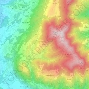
Name: Scerizza topographic map, elevation, terrain.
Location: Scerizza, Nava, Colle Brianza, Lecco, Lombardia, 23884, Italia (45.74668 9.35177 45.78668 9.39177)
Average elevation: 549 m
Minimum elevation: 268 m
Maximum elevation: 878 m
Thank you for supporting this site ❤️
Make a donation
Make a donation
Gear up for your next adventure:
As an Amazon Associate, this site earns from qualifying purchases at no extra cost to you.