Geolocate

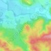
Velim topographic map

Click on the map to display elevation.

About this map

Name: Velim topographic map, elevation, terrain.

Location: Velim, okres Kolín, Central Bohemian Region, Central Bohemia, 281 01, Czechia (50.03715 15.07834 50.08617 15.13702)

Average elevation: 215 m

Minimum elevation: 190 m

Maximum elevation: 276 m

Other topographic maps

Click on a map to view its topography, its elevation and its terrain.

Studce

Czechia > Central Bohemian Region

Average elevation: 235 m

Trojhran

Czechia > Central Bohemian Region > Žehrov

Average elevation: 285 m

Mezivrata

Czechia > Central Bohemian Region > Neustupov

Average elevation: 630 m

Gear up for your next adventure:

🥾Approach Shoes - Shoes designed for climbing approaches and rugged trails
🛰️Satellite Messenger - Emergency communication for areas with no cell service
🧦Thermal Socks - Warm socks for winter hiking or camping
🧤Rechargeable Heated Gloves - Extreme warmth for Canadian winter expeditions
💧Hydration Bladder - Hands-free hydration solution for long treks

As an Amazon Associate, this site earns from qualifying purchases at no extra cost to you.