
库拉木勒克乡 topographic map
Interactive map
Click on the map to display elevation.
About this map
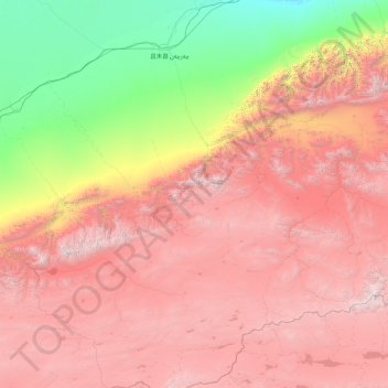
Name: 库拉木勒克乡 topographic map, elevation, terrain.
Location: 库拉木勒克乡, 且末县, 巴音郭楞蒙古自治州, Xinjiang, China (35.74315 85.49047 38.53358 87.97314)
Average elevation: 3,558 m
Minimum elevation: 1,067 m
Maximum elevation: 6,726 m