
Greenwood topographic map
Interactive map
Click on the map to display elevation.
About this map
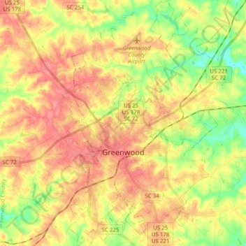
Name: Greenwood topographic map, elevation, terrain.
Location: Greenwood, Greenwood County, South Carolina, United States (34.14701 -82.19962 34.27337 -82.10270)
Average elevation: 180 m
Minimum elevation: 140 m
Maximum elevation: 211 m