
Thank you for supporting this site ❤️
Make a donation
Make a donation
Gear up for your next adventure:
As an Amazon Associate, this site earns from qualifying purchases at no extra cost to you.
Gürleyk topographic map
Click on the map to display elevation.
Thank you for supporting this site ❤️
Make a donation
Make a donation
Gear up for your next adventure:
As an Amazon Associate, this site earns from qualifying purchases at no extra cost to you.
About this map
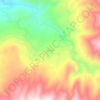
Name: Gürleyk topographic map, elevation, terrain.
Location: Gürleyk, Dalaman, Muğla, Aegean Region, Turkey (36.89749 29.01713 36.93749 29.05713)
Average elevation: 749 m
Minimum elevation: 307 m
Maximum elevation: 1,144 m
Thank you for supporting this site ❤️
Make a donation
Make a donation
Gear up for your next adventure:
As an Amazon Associate, this site earns from qualifying purchases at no extra cost to you.