Geolocate

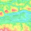
Grange topographic map

Click on the map to display elevation.

About this map

Name: Grange topographic map, elevation, terrain.

Location: Grange, Lehenagh, Cork, County Cork, Munster, T12 HN2E, Ireland (51.85467 -8.46025 51.87223 -8.44459)

Average elevation: 81 m

Minimum elevation: 3 m

Maximum elevation: 169 m

Other topographic maps

Click on a map to view its topography, its elevation and its terrain.
Cork

Ireland > County Cork > Cork

Average elevation: 94 m

Tramore Valley Park

Ireland > County Cork > Cork

Average elevation: 28 m

Upper Glanmire Bridge

Ireland > County Cork > Cork

Average elevation: 90 m

Kerry Pike

Ireland > County Cork > Cork

Average elevation: 55 m

Fair Hill

Ireland > County Cork > Cork

Average elevation: 68 m

Ballincollig Regional Park

Ireland > County Cork > Cork

Average elevation: 55 m

Ballincollig

Ireland > County Cork > Cork

Average elevation: 62 m

Beaumont Park

Ireland > County Cork > Cork

Average elevation: 12 m

River Lee (North Channel)

Ireland > County Cork > Cork

Average elevation: 49 m

Stone Beach

Ireland > County Cork > Cork

Average elevation: 47 m

River Lee (North Channel)

Ireland > County Cork > Cork

Average elevation: 32 m

Gear up for your next adventure:

🪑Ultralight Camping Stool - Compact seating for rest stops during long hikes
🧶550 Survival Paracord - Versatile utility cord for emergency repairs and rigging
🥾Hiking Gaiters - Protect legs and shoes from mud, snow, and debris
🧴Insect Repellent - Protect yourself from bugs during outdoor adventures
🗺️Topographic Maps - Detailed maps to explore trails, mountains, and wilderness areas

As an Amazon Associate, this site earns from qualifying purchases at no extra cost to you.