Geolocate

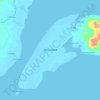
Talabaan topographic map

Click on the map to display elevation.

About this map

Name: Talabaan topographic map, elevation, terrain.

Location: Talabaan, Zamboanga City, Zamboanga Peninsula, 7000, Philippines (6.93661 122.15531 6.97661 122.19531)

Average elevation: 5 m

Minimum elevation: -1 m

Maximum elevation: 21 m

Other topographic maps

Click on a map to view its topography, its elevation and its terrain.

Sacol Island

Philippines > Zamboanga City

Average elevation: 6 m

Vitali River

Philippines > Zamboanga City > Mangusu

Average elevation: 27 m

Sinunug Island

Philippines > Zamboanga City

Average elevation: 0 m

Plaza Pershing

Philippines > Zamboanga City

Average elevation: 4 m

Gear up for your next adventure:

🔥Emergency Fire Starter - Reliable ignition source for all weather conditions
🔦UV Flashlight - Detect minerals or specific insects in the dark
🥾Waterproof Hiking Boots - Boots keeping your feet dry in wet conditions
🛰️Satellite Messenger - Emergency communication for areas with no cell service
🔭Outdoor Binoculars - Lightweight binoculars for birdwatching and hiking

As an Amazon Associate, this site earns from qualifying purchases at no extra cost to you.