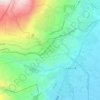
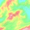
Fourzol topographic map
Click on the map to display elevation.
Fourzol
Ferzol (Levantine Arabic: الفرزل, romanized: il-Firzul), also spelled Forzol, Ferzul or Fourzol, is a village located in the Zahlé District of the Beqaa Governorate in Lebanon. It lies approximately six to eight kilometres north of Zahlé, the principal city of the Beqaa Valley, along the road toward Baalbek, at an elevation of roughly 1,000 metres above sea level. It is situated south of Nabi Ayla and west of Ablah. Today, Ferzol is home to a mostly Melkite Greek Catholic community, and is administratively part of the broader Zahlé municipality, though it maintains its own municipal council.
About this map

Name: Fourzol topographic map, elevation, terrain.
Location: Fourzol, Zahlé District, Beqaa Governorate, 8442, Lebanon (33.82671 35.91707 33.90205 35.98044)
Average elevation: 1,075 m
Minimum elevation: 883 m
Maximum elevation: 1,789 m
Other topographic maps
Click on a map to view its topography, its elevation and its terrain.


Qaraoun
The development activity near the village, consequent to land area the Qaraoun village transferred for building of the El Qaraoun Dam in the middle reaches of the Litani River, which created an artificial lake (33°34′11.63″N 35°41′51.18″E / 33.5698972°N 35.6975500°E / 33.5698972;…
Average elevation: 1,027 m

Zahle
Zahlé is located 55 km (34 mi) east of the capital Beirut, close to the Beirut-Damascus road, and lies at the junction of Mount Lebanon and the Beqaa Valley, at a mean elevation of 1,000 m. Established in the 18th century by Christians, Zahlé maintains its predominantly Greek Catholic character. The city has…
Average elevation: 1,281 m

Kfar Mishki
Kfarmishki, also spelled Kfar Mishki or Kfar Mechki (Arabic: كفرمشكي), is a small mountain authority in the Rashaya District of the Beqaa Governate in Lebanon. This village is located approximately 92 km southeast of Beirut and lies at an altitude of 950–1350 m above sea level on the western slope of…
Average elevation: 1,043 m

Zahle
Zahlé is located 55 km (34 mi) east of the capital Beirut, close to the Beirut-Damascus road, and lies at the junction of Mount Lebanon and the Beqaa Valley, at a mean elevation of 1,000 m. Established in the 18th century by Christians, Zahlé maintains its predominantly Greek Catholic character. The city has…
Average elevation: 1,281 m


Yanta
The village sits about 1,540 metres (5,050 ft) above sea level. The name is variously claimed to mean "God sows" or "God the sower" in Semitic, "white dove" in Syriac and "elevation" in Arabic. It has been noted that a special type of yellow marl (lake sediments) has been noticed in Yanta and the surrounding…
Average elevation: 1,450 m