
Make a donation
Gear up for your next adventure:
As an Amazon Associate, this site earns from qualifying purchases at no extra cost to you.
Eickelborn topographic map
Click on the map to display elevation.
Make a donation
Gear up for your next adventure:
As an Amazon Associate, this site earns from qualifying purchases at no extra cost to you.
About this map
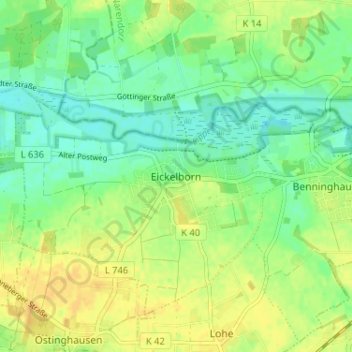
Name: Eickelborn topographic map, elevation, terrain.
Average elevation: 79 m
Minimum elevation: 67 m
Maximum elevation: 91 m
Make a donation
Gear up for your next adventure:
As an Amazon Associate, this site earns from qualifying purchases at no extra cost to you.
Other topographic maps
Click on a map to view its topography, its elevation and its terrain.
Lipperode
Deutschland > Nordrhein-Westfalen > Kreis Soest > Lippstadt
Doch was ereignete sich tatsächlich? Im Dezember 1812 befanden sich Teile der französischen Armee und auch das Bataillon Lippe auf dem Rückzug von Kowno (Ort im Süden Litauens) über Gumbinen nach Tilsit. Es war Winter und natürlich sehr kalt, die Straßen waren glatt und verdreckt, die Flucht wenig…
Average elevation: 78 m
Make a donation
Gear up for your next adventure:
As an Amazon Associate, this site earns from qualifying purchases at no extra cost to you.
Dedinghausen
Deutschland > Nordrhein-Westfalen > Kreis Soest > Lippstadt
Der neue Schulkomplex bestand aus einer Grundschule, einer Hauptschule sowie einer Sport- und einer Lehrschwimmhalle. Nach ihrer Schließung wurde die Hauptschule zur Westfälischen Wirtschaftsakademie für Physiotherapie und Ergotechnik umgebaut. Die Grundschule und die Berufsakademie bilden gemeinsam einen…
Average elevation: 89 m
Make a donation
Gear up for your next adventure:
As an Amazon Associate, this site earns from qualifying purchases at no extra cost to you.