
Thank you for supporting this site ❤️
Make a donation
Make a donation
Gear up for your next adventure:
As an Amazon Associate, this site earns from qualifying purchases at no extra cost to you.
Peñalisa topographic map
Click on the map to display elevation.
Thank you for supporting this site ❤️
Make a donation
Make a donation
Gear up for your next adventure:
As an Amazon Associate, this site earns from qualifying purchases at no extra cost to you.
About this map
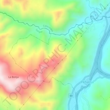
Name: Peñalisa topographic map, elevation, terrain.
Location: Peñalisa, Salgar, Suroeste, Antioquia, Colombia (5.92935 -75.88603 5.95678 -75.84862)
Average elevation: 771 m
Minimum elevation: 516 m
Maximum elevation: 1,167 m
Thank you for supporting this site ❤️
Make a donation
Make a donation
Gear up for your next adventure:
As an Amazon Associate, this site earns from qualifying purchases at no extra cost to you.