Geolocate

Pegram topographic map

Click on the map to display elevation.

About this map

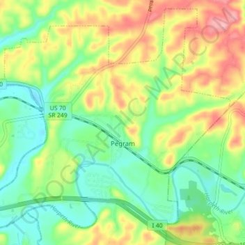
Name: Pegram topographic map, elevation, terrain.

Location: Pegram, Cheatham County, Tennessee, 37143, United States (36.07890 -87.09039 36.13173 -87.02041)

Average elevation: 195 m

Minimum elevation: 144 m

Maximum elevation: 272 m

Gear up for your next adventure:

🛶Kayak Dry Bag - Waterproof storage for kayaking adventures
🧥Ultralight Puffy Jacket - Maximum warmth that packs down to the size of an orange
🧢Hiking Sun Hat - Wide-brimmed protection for exposed mountain ridges
🚲MTB Frame Bag - Carry tools and maps directly on your bicycle frame
🚲Handlebar Phone Mount - View topographic-map.com live while cycling

As an Amazon Associate, this site earns from qualifying purchases at no extra cost to you.