Geolocate

Santa Rosa topographic map

Click on the map to display elevation.

About this map

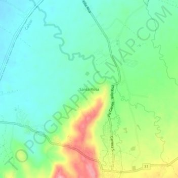
Name: Santa Rosa topographic map, elevation, terrain.

Location: Santa Rosa, Caloto, Norte, Cauca, RAP Pacífico, Colombia (3.03429 -76.43299 3.07429 -76.39299)

Average elevation: 1,057 m

Minimum elevation: 1,014 m

Maximum elevation: 1,150 m

Gear up for your next adventure:

👖Convertible Hiking Pants - Zip-off legs to adapt to changing weather conditions
🎒Hiking Backpack - Lightweight and ergonomic backpacks for day hikes or multi-day treks
🥾Waterproof Hiking Boots - Essential footwear for rugged terrain and wet Canadian trails
🧭GPS Outdoor Watch - Smart watch for navigation and fitness tracking in nature
🧦Crew Hiking Socks - Comfortable socks for long-distance hikes

As an Amazon Associate, this site earns from qualifying purchases at no extra cost to you.