Geolocate

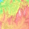
Carnés topographic map

Click on the map to display elevation.

About this map

Name: Carnés topographic map, elevation, terrain.

Location: Carnés, Vimianzo, Tierra de Soneira, La Coruña, Galicia, 15129, España (43.09414 -9.13245 43.13414 -9.09245)

Average elevation: 105 m

Minimum elevation: -1 m

Maximum elevation: 323 m

Other topographic maps

Click on a map to view its topography, its elevation and its terrain.

Vimianzo

España > Galicia > Tierra de Soneira

Average elevation: 222 m

Baio

España > Galicia > Tierra de Soneira > Zas

Average elevation: 198 m

Camelle

España > Galicia > Tierra de Soneira > Camariñas

Average elevation: 87 m

Calo

España > Galicia > Tierra de Soneira

Average elevation: 166 m

Bamiro

España > Galicia > Tierra de Soneira

Average elevation: 184 m

Zas

España > Galicia > Tierra de Soneira

Average elevation: 293 m

Brandoñas

España > Galicia > Tierra de Soneira > Zas

Average elevation: 296 m

Camariñas

España > Galicia > Tierra de Soneira

Coordenadas geográficas de Camariñas: Latitud: 43.1286, Longitud: -9.18493 - 43° 7′ 43″ Norte, 9° 11′ 6″ Oeste. Superficie de Camariñas: 5.160 hectáreas o 51,60 km². Altitud de Camariñas: 10 m.

Average elevation: 27 m

Gear up for your next adventure:

🥾Hiking Shorts - Breathable shorts suitable for summer hikes
🎒Fully Waterproof Backpack - Total protection for photography gear and electronics
🥾Waterproof Hiking Boots - Boots keeping your feet dry in wet conditions
🥽Outdoor Goggles - Protective eyewear for outdoor activities
🧢Hiking Sun Hat - Wide-brimmed protection for exposed mountain ridges

As an Amazon Associate, this site earns from qualifying purchases at no extra cost to you.