Geolocate

Springbrook topographic map

Click on the map to display elevation.

About this map

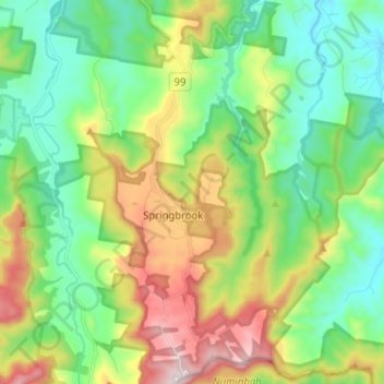
Name: Springbrook topographic map, elevation, terrain.

Location: Springbrook, Queensland, Australia (-28.24131 153.23762 -28.12913 153.31729)

Average elevation: 370 m

Minimum elevation: 59 m

Maximum elevation: 1,000 m

Gear up for your next adventure:

🔥Camping Stove - Portable stoves to cook outdoors with ease
💧Hydration Pack - Hands-free hydration system for long hikes
Camping Coffee Maker - Brew fresh coffee anywhere on the topographic map
🥾Mountain Hiking Shoes - Shoes with superior grip for mountainous terrain
🥾All-Terrain Hiking Boots - Versatile boots for varied hiking conditions

As an Amazon Associate, this site earns from qualifying purchases at no extra cost to you.