Geolocate

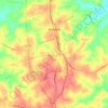
Adger topographic map

Click on the map to display elevation.

About this map

Name: Adger topographic map, elevation, terrain.

Location: Adger, Fairfield County, South Carolina, 29176, United States (34.41649 -81.14574 34.45649 -81.10574)

Average elevation: 147 m

Minimum elevation: 115 m

Maximum elevation: 172 m

Other topographic maps

Click on a map to view its topography, its elevation and its terrain.
Gear up for your next adventure:

🧊Portable Cooler - Keep food and drinks cold during outdoor adventures
🥾Mountain Hiking Boots - High-traction boots for rocky terrain
🥾Hiking Gaiters - Protect legs and shoes from mud, snow, and debris
🧤Rechargeable Heated Gloves - Extreme warmth for Canadian winter expeditions
💡LED Headlamp - Hands-free illumination for night hiking and camping

As an Amazon Associate, this site earns from qualifying purchases at no extra cost to you.