Geolocate

Pagermaneuh topographic map

Click on the map to display elevation.

About this map

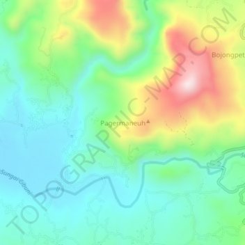
Name: Pagermaneuh topographic map, elevation, terrain.

Location: Pagermaneuh, Cianjur, West Java, 43266, Indonesia (-7.27023 107.07582 -7.23023 107.11582)

Average elevation: 314 m

Minimum elevation: 160 m

Maximum elevation: 652 m

Other topographic maps

Click on a map to view its topography, its elevation and its terrain.

Kertajadi

Indonesia > West Java > Cianjur

Average elevation: 108 m

Agrabinta

Indonesia > West Java > Cianjur

Average elevation: 108 m

Cidaun

Indonesia > West Java > Cianjur

Average elevation: 658 m

Karangwangi

Indonesia > West Java > Cianjur

Average elevation: 119 m

Wanasari

Indonesia > West Java > Cianjur

Average elevation: 31 m

Jayapura

Indonesia > West Java > Cianjur

Average elevation: 73 m

Cisalak

Indonesia > West Java > Cianjur

Average elevation: 49 m

Gear up for your next adventure:

🧴Bear Spray Holster - Quick-access carry for essential Canadian wilderness safety
🥾Hiking Leggings - Comfortable leggings for outdoor activities
🧼Biodegradable Camp Soap - Environmentally friendly cleaning for gear and body
💡Portable Camping Lamp - Rechargeable lamp for campsite lighting
🧰Survival Kit - Essential gear for emergencies in the wilderness

As an Amazon Associate, this site earns from qualifying purchases at no extra cost to you.