Geolocate

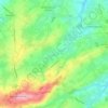
Mitrecamp topographic map

Click on the map to display elevation.

About this map

Name: Mitrecamp topographic map, elevation, terrain.

Location: Mitrecamp, Livry, Caumont-sur-Aure, Vire, Calvados, Normandie, France métropolitaine, 14240, France (49.08278 -0.81259 49.12278 -0.77259)

Average elevation: 167 m

Minimum elevation: 112 m

Maximum elevation: 246 m

Other topographic maps

Click on a map to view its topography, its elevation and its terrain.
14240

France > Normandie > Calvados > Caumont-sur-Aure

Average elevation: 136 m

Livry

France > Normandie > Calvados > Caumont-sur-Aure

Average elevation: 143 m

Gear up for your next adventure:

🥾Waterproof Trail Shoes - Shoes designed to handle wet terrain
🧴Sunscreen SPF - Broad-spectrum sunscreen for outdoor activities
🩹Moleskin Blister Pads - Direct protection for painful foot pressure points
🥾Waterproof Hiking Boots - Essential footwear for rugged terrain and wet Canadian trails
⛺Camping Tent - Weather-resistant tents suitable for 2 to 6 people

As an Amazon Associate, this site earns from qualifying purchases at no extra cost to you.