

Puebla topographic map
Click on the map to display elevation.
Puebla
The Sierra del Tentzon and higher elevations of Malinche volcano still conserve the Trans-Mexican Volcanic Belt pine-oak forests ecoregion – with forests of pine, holm oak and other tree species. In the pine forests, Montezuma Pine (Pinus montezumae) is generally predominant, with Hartweg's Pine (Pinus hartwegii) and Pinus teocote in dry areas with shallow soils. Pine-fir forests are composed almost entirely of Hartweg's Pine (Pinus hartwegii) and Sacred Fir (Abies religiosa).
About this map
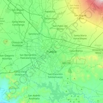
Name: Puebla topographic map, elevation, terrain.
Location: Puebla, Municipio de Puebla, Puebla, 72000, Mexico (18.88372 -98.35815 19.20372 -98.03815)
Average elevation: 2,233 m
Minimum elevation: 1,829 m
Maximum elevation: 3,633 m