
Włodawa topographic map
Interactive map
Click on the map to display elevation.
About this map
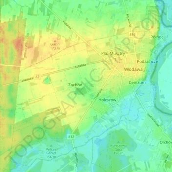
Name: Włodawa topographic map, elevation, terrain.
Location: Włodawa, Włodawa County, Lublin Voivodeship, 22-200, Poland (51.51552 23.48950 51.56708 23.57810)
Average elevation: 166 m
Minimum elevation: 151 m
Maximum elevation: 184 m