

Dindigul topographic map
Click on the map to display elevation.
Dindigul
Dindugul is located at 10°21′N 77°57′E / 10.35°N 77.95°E / 10.35; 77.95 and has an average elevation of 265 m (869 ft). The town is in Dindigul district, 420 km (260 mi) from Chennai and 100 km (62 mi) south-west of Tiruchirappalli. Dindigul is located in the foothills of Sirumalai hills. The topography is plain and hilly, with the variation resulting in climatic changes. There are no notable mineral resources available in and around the town. The soil type is thin veneer soil, which is mostly black clayey soil with red soil. Summer season is from March to July, while December to January marks the winter season. The temperature ranges from a maximum of 37 °C (99 °F) to a minimum of 27 °C (81 °F) during summer and a maximum of 26 °C (79 °F) to a minimum of 16 °C (61 °F) during winter. Dindigul receives rainfall with an average of 812 mm (32.0 in) annually. The Southwest monsoon, with an onset in June and lasting up to August, brings scanty rainfall. Bulk of the rainfall is received during the North East monsoon in the months of October, November and December.
About this map
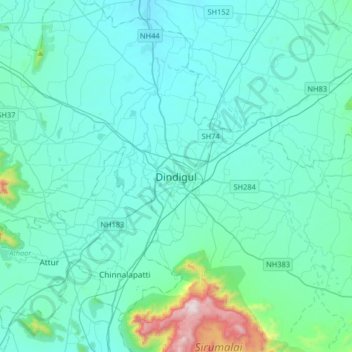
Name: Dindigul topographic map, elevation, terrain.
Location: Dindigul, Tamil Nadu, 624001, India (10.20565 77.80933 10.52565 78.12933)
Average elevation: 333 m
Minimum elevation: 208 m
Maximum elevation: 1,362 m