Geolocate

Santa Isabel topographic map

Click on the map to display elevation.

About this map

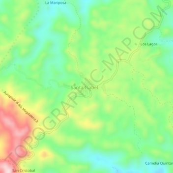
Name: Santa Isabel topographic map, elevation, terrain.

Location: Santa Isabel, Remedios, Nordeste, Antioquia, Colombia (6.92523 -74.76256 6.96523 -74.72256)

Average elevation: 831 m

Minimum elevation: 705 m

Maximum elevation: 1,034 m

Gear up for your next adventure:

🛶Canoe Life Vest - Safety vest for water sports
🥾All-Terrain Hiking Boots - Versatile boots for varied hiking conditions
🔦LED Flashlight - Powerful and long-lasting flashlight for camping and emergencies
🧦Hiking Socks - Moisture-wicking and comfortable socks for long hikes
🔦LED Headtorch - Bright and durable light for night activities

As an Amazon Associate, this site earns from qualifying purchases at no extra cost to you.