Geolocate

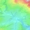
Le Pinod topographic map

Click on the map to display elevation.

About this map

Name: Le Pinod topographic map, elevation, terrain.

Location: Le Pinod, Novalaise, Chambéry, Savoie, Auvergne-Rhône-Alpes, France métropolitaine, 73470, France (45.56193 5.74592 45.60193 5.78592)

Average elevation: 495 m

Minimum elevation: 377 m

Maximum elevation: 682 m

Other topographic maps

Click on a map to view its topography, its elevation and its terrain.
73470

France > Auvergne-Rhône-Alpes > Savoie > Novalaise > Carabin

Average elevation: 491 m

Gear up for your next adventure:

🛌Down Sleeping Bag - Superior warmth-to-weight ratio for cold nights
🔋Emergency Crank Radio - Weather alerts and power without needing batteries
🦶Anti-Blister Balm - Prevents friction and hotspots during long ascents
🧢Hiking Hat - Sun-protective and breathable hats for long treks
🧥Waterproof Pants - Keep dry during rainy hiking conditions

As an Amazon Associate, this site earns from qualifying purchases at no extra cost to you.