Geolocate

Proieni topographic map

Click on the map to display elevation.

About this map

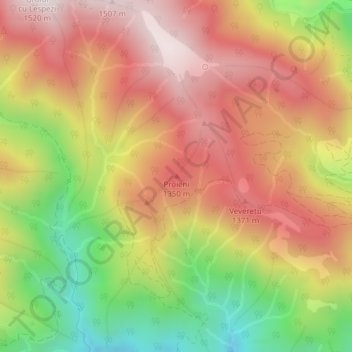
Name: Proieni topographic map, elevation, terrain.

Location: Proieni, Brezoi, Vâlcea, Romania (45.43214 24.18219 45.43224 24.18229)

Average elevation: 1,170 m

Minimum elevation: 756 m

Maximum elevation: 1,490 m

Gear up for your next adventure:

🧦Thermal Socks - Warm socks for winter hiking or camping
🔦LED Flashlight - Powerful and long-lasting flashlight for camping and emergencies
🦯Trekking Poles - Reduced impact on joints for steep topographic climbs
🥾Hiking Shorts - Breathable shorts suitable for summer hikes
🥾Waterproof Hiking Boots - Essential footwear for rugged terrain and wet Canadian trails

As an Amazon Associate, this site earns from qualifying purchases at no extra cost to you.